Equipping mother nature with drones and AI
- IoT
- computer vision
- Segmenting
How to automate the monitoring of Finnish nature in order to make research and nature management more efficient?
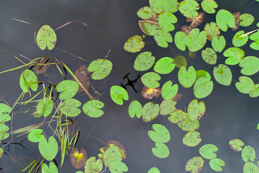
Using drones and image recognition to detect and estimate types and volumes of aquatic species.
Finnish nature is under constant surveillance and monitoring to keep it safe. For example, finding and removing invasive alien species is crucial for the ecosystem, but it has proven hard to execute, as scientists struggle to cover all of the needed areas. Additionally, monitoring water and biomass in lake areas is not easy or efficient, as it often has to be done in person. That is why Suomen Ympäristökeskus - Finnish environment institute (SYKE) decided that it was time to lend mother nature a hand and equip her with drones.
Drones are able to cover large areas in a significantly short amount of time, which helps scientists to gain huge amounts of video data of our environment. However, even with quickly collected footage, scientists can not spend hours scavenging for alien species or estimating water levels, because all that time is taken away from actual analysis.
But with machine learning, automated recognition can be utilized to recognize the water and ice levels, different species and even estimating in biomass. This removes the tedious measuring and monitoring from the process and gives scientists more time to focus on analysis of the research findings.
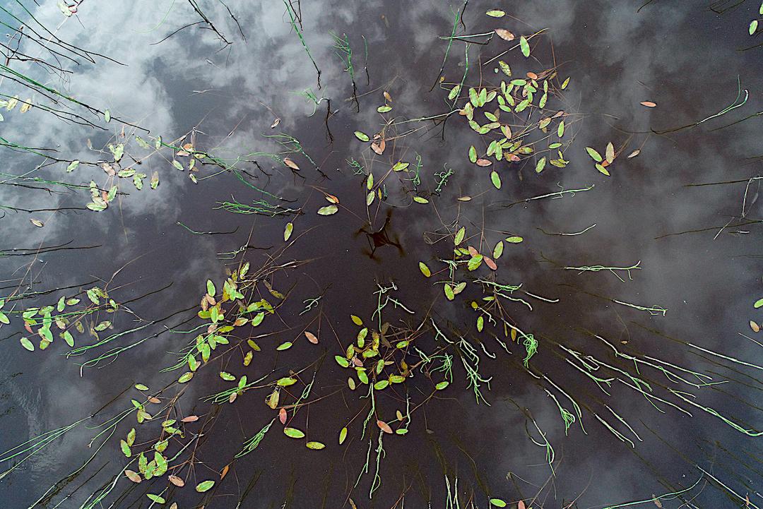
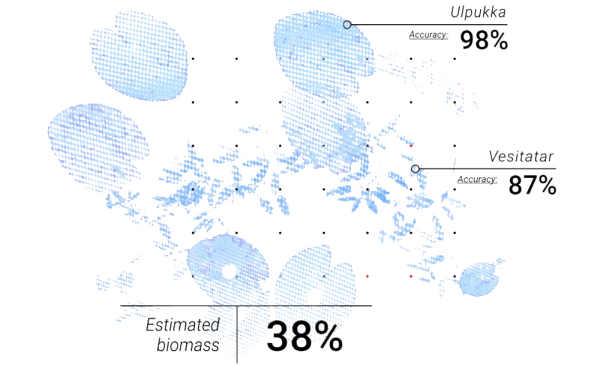
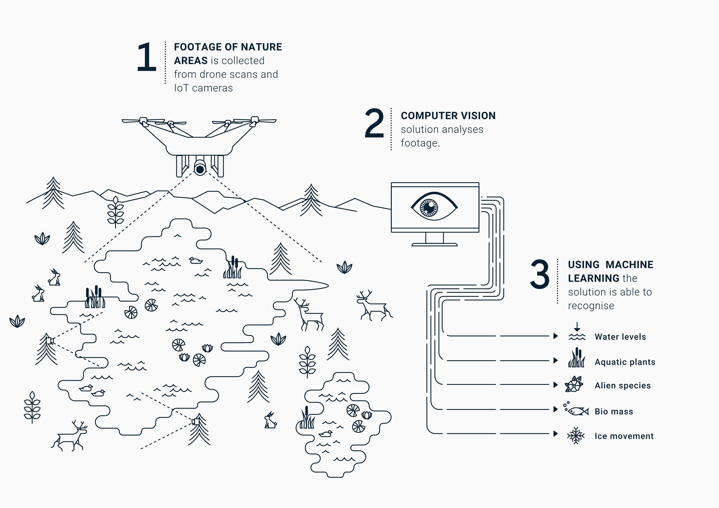
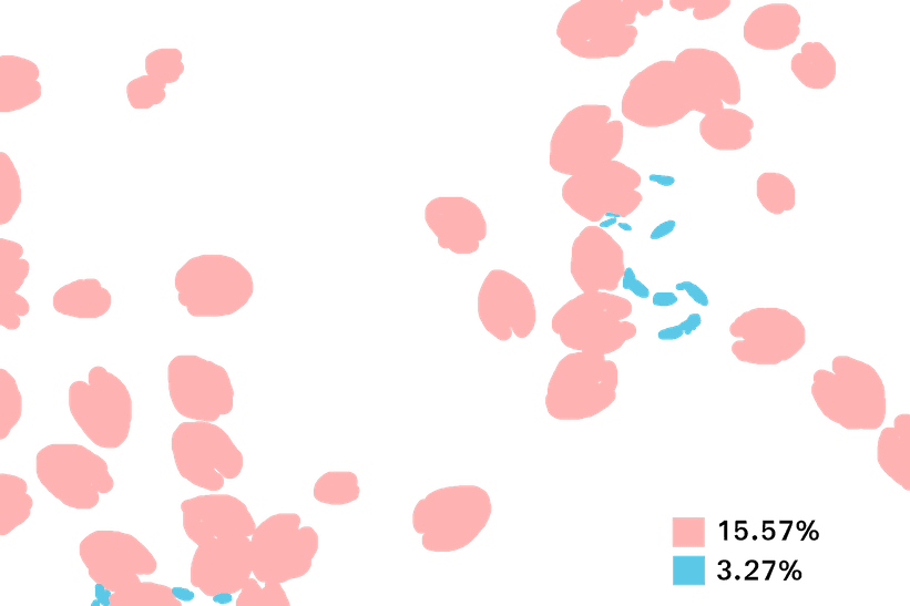
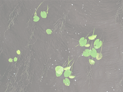
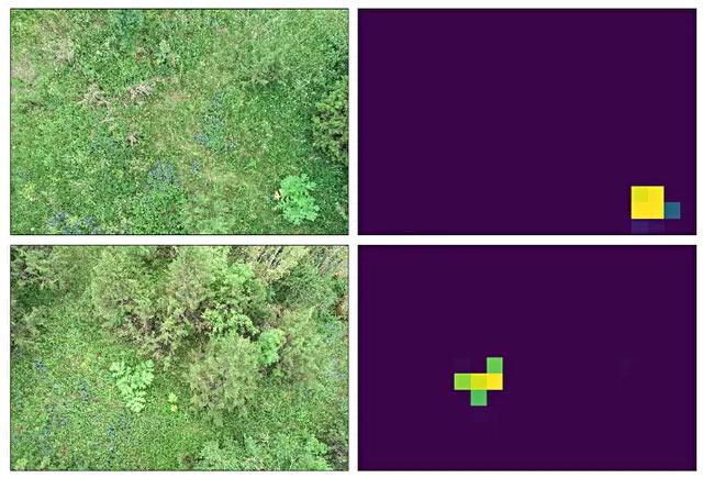
We built several neural models to recognize the different areas of interest from images. The images were taken by trail cameras monitoring the water levels, or by drones which performed fly-bys over Finnish wilderness, looking for alien species among other things. The models were trained with various schemes, some of which were hand-annotated from fly-by imagery to deliver state-of-the-art recognition (aquatic plants and alien species), or by automatically generated datasets (water levels). These models generate masks over images which denote what exact pixels belong to the detected object. With this it is easy to calculate the area of water plants, for example, which gives the biomass estimation directly. After this, the data is sent to servers for recognition tasks, either automatically from trail cameras or manually from drone flights. With these classifications we can then construe reports for the experts to interpret.
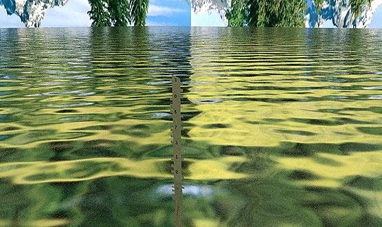
There are thousands of water level measurement stations around Finland which use mostly pressure based sensors to track the water level. Problem with these sensors is that they drift from time to time, and researchers need to do regular calibration. Some stations also had cameras, so the question was could we use the cameras as additional sensors and enrich water level measurement or monitor ice movement and so reduce calibration visits.
We didn't have a training set for water level recognition, so we trained a mask model with only 3D rendered virtual images. That helped us to get to the level where we could just fine tune the model with actual real world data.
Invasive alien species cause economic, environmental, social and health-related problems. One part of the project was to research computer vision models that can recognize species we want to control, and develop systems for mapping them semi-autonomously. During the project drones were deployed in multiple areas for mapping and recognizing targets.
After we know what species there are, and how much area they are taking, we are able to estimate the biomass for the area. This information is important when SYKE is tracking the health of these lakes over longer periods of time.
Estimating ice levels and analyzing ice movement will help when SYKE is researching flooding. In future, accurate prediction will also help figuring out countermeasures for such events. Ice jam floods are less predictable and potentially more destructive than open-water flooding.